
Surprise ZIP Directory Coverage
Six ZIPs are significant in Surprise parcel geography. Four carry most of the familiar central, northern, and western city areas. A smaller eastern ZIP remains genuine, and a Wittmann postal code reaches far northwestern land under Surprise jurisdiction. The coverage notes below describe practical search zones. They are not legal boundary lines or counts of people.
| ZIP | Areas Covered | Post Office | Notes |
|---|---|---|---|
| 85374 | Central and north-central Surprise; The Grand vicinity | Surprise postal service | Established core; postal and city lines differ |
| 85378 | East and older Surprise near Bell Road and Sun City West | Routed with 85379 | Smaller but genuine Surprise ZIP |
| 85379 | Central and south Surprise subdivisions | Surprise postal service | Verify parcel situs and jurisdiction |
| 85387 | North Surprise and new-growth areas | Routed with 85379 | Large, lower-density postal area |
| 85388 | Southwest and west Surprise; newer subdivisions | Routed with 85374 | Check annexation and parcel record |
| 85361 | Far northwestern territory near Rio Rancho Estates and Churchill South | Wittmann postal geography may appear | Strongest city-postal mismatch |
The main Surprise Post Office is at 14955 W. Bell Road, Surprise, AZ 85374-9998. Research did not identify an official Surprise PO-box-only or unique institutional ZIP list, so none is implied here. Use the postal service for the delivery code and local government records for jurisdiction.
Surprise ZIP Areas Compared
The 85374 zone is tied to central and north-central Surprise and The Grand vicinity. ZIP 85379 takes in many central and southern subdivisions. Farther north, 85387 covers broad new-growth land, while 85388 follows western and southwestern growth. These place descriptions are search anchors, not fixed neighborhood definitions. Development names, plats, and annexations can cross a postal line.
County parcel-layer queries add scale. Among parcels whose jurisdiction field equaled Surprise, the inspected results were about 20,659 in 85374, 17,530 in 85379, 21,850 in 85387, and 13,826 in 85388. Those figures count parcels, not homes or residents. They change as land splits or combines, and some records have blank or anomalous physical ZIP fields.
Major roads and Loop 303 can be better location clues than the ZIP code alone. Asante, Marley Park, Rancho Gabriela, Greer Ranch, Surprise Farms, Sierra Montana, and Sterling Grove are also useful subdivision terms in county searches. None should be treated as a ZIP, a formal municipal boundary, or proof of a current household.
Surprise Records in 85378 and 85361
ZIP 85378 is a real but smaller Surprise area near Bell Road and the Sun City West edge. The inspected county layer returned about 3,057 Surprise-jurisdiction parcels there. Searchers often miss it by assuming all east-side Surprise addresses use a larger core ZIP. Adjacent Sun City and Sun City West place labels can also appear in directory or postal geography.
ZIP 85361 creates a clearer mismatch. The county query showed about 703 parcels tagged to Surprise jurisdiction while Wittmann postal geography may appear in the address. That means “Wittmann” on mail does not settle which city governs the land. Compare the Assessor jurisdiction field, official municipal boundary, and recorded subdivision or legal description.
Note: Small single-digit results in other ZIPs are better treated as parcel-data anomalies until an official source confirms normal Surprise coverage.
The 2016 Surprise ZIP Split
A documented postal change explains part of today's map. USPS Postal Bulletin 22450 records that 85387 was split or realigned from parent 85378 and routed with Surprise 85379. The same 2016 action split or realigned 85388 from 85378 and routed it with Surprise 85374. Old records created before the change may therefore carry a former ZIP even when the street and parcel remain the same.
Keep both the old and current ZIP when tracing an address across time. Search deeds by party, document number, or legal description because the Recorder has no documented ZIP filter. A title chain follows the land. Postal edits do not rewrite old instruments, plats, permits, or directory entries.
This split also warns against using a present ZIP code directory as a historical roll. A 2015 address and a current delivery address can differ without a move. The date on the source decides which postal code is plausible.
Find Surprise Residents by ZIP
A ZIP search works best as a narrowing step. First confirm the delivery code. Then find parcels in that physical ZIP and compare city jurisdiction. A ZIP-wide result is too broad to identify an occupant, and an owner field does not list everyone at the address. Once the right area and parcel are known, the Surprise street directory workflow handles the address-level chain.
- Verify the full address with the official USPS city-and-state or address lookup. Save the standardized street form and ZIP.
- Enter the five-digit physical ZIP in the Maricopa County Assessor search. Narrow with an owner, address, subdivision, or APN when possible.
- Open Parcel Viewer and inspect the selected parcel's physical ZIP, jurisdiction, legal description, and nearby subdivision geography.
- Copy the APN and owner name. Use them only as record leads, since parcel ownership is not the same as household occupancy.
- Move to the Recorder by deed number, party, or legal description when the goal is ownership history.
The USPS ZIP Code Lookup is the correct first stop for postal validation. Its form is shown below.
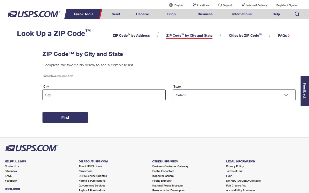
The form confirms postal coding. It does not identify residents, parcel owners, or incorporation.
Search Surprise Records With ZIP
The Maricopa County Assessor accepts far more than a ZIP. Combining fields reduces the chance of mixing parcels from a broad growth area. An APN is the assessor's parcel number. MCR refers to a recorded subdivision map, while STR means section, township, and range for land described through the survey grid.
| Search Mode | Format | Best ZIP Directory Use |
|---|---|---|
| City or ZIP Code | City name or five digits | Build the first parcel set |
| Address | Number, direction, street, abbreviated type | Narrow a ZIP to one property |
| Owner Name | Full owner name; do not shorten first name | Compare same-name parcels |
| Parcel Number | With or without punctuation | Open the exact parcel card |
| Subdivision or MCR | Name or map number | Group related plats inside a ZIP |
| STR | Section, township, and range required | Research unsubdivided northern land |
The parcel card separates situs, or physical location, from the owner's tax-mailing destination. It can also show legal description, subdivision, deed references, sale data, valuation, and property traits. A mailing ZIP in another city or state must never be counted as the Surprise property's ZIP.
Surprise ZIP Maps Stop at 1,000
Parcel Viewer offers Search By modes for APN, parcel owner, subdivision name or MCR, section-township-range, ZIP Code, and Map ID. A ZIP search can zoom to a useful area and fill the results tab. Yet the viewer selects only the first 1,000 features. Every major Surprise ZIP has far more parcels, so the displayed set cannot serve as a full resident or parcel count.
The official Parcel Viewer search help explains those modes and the cap. The interface is pictured below.
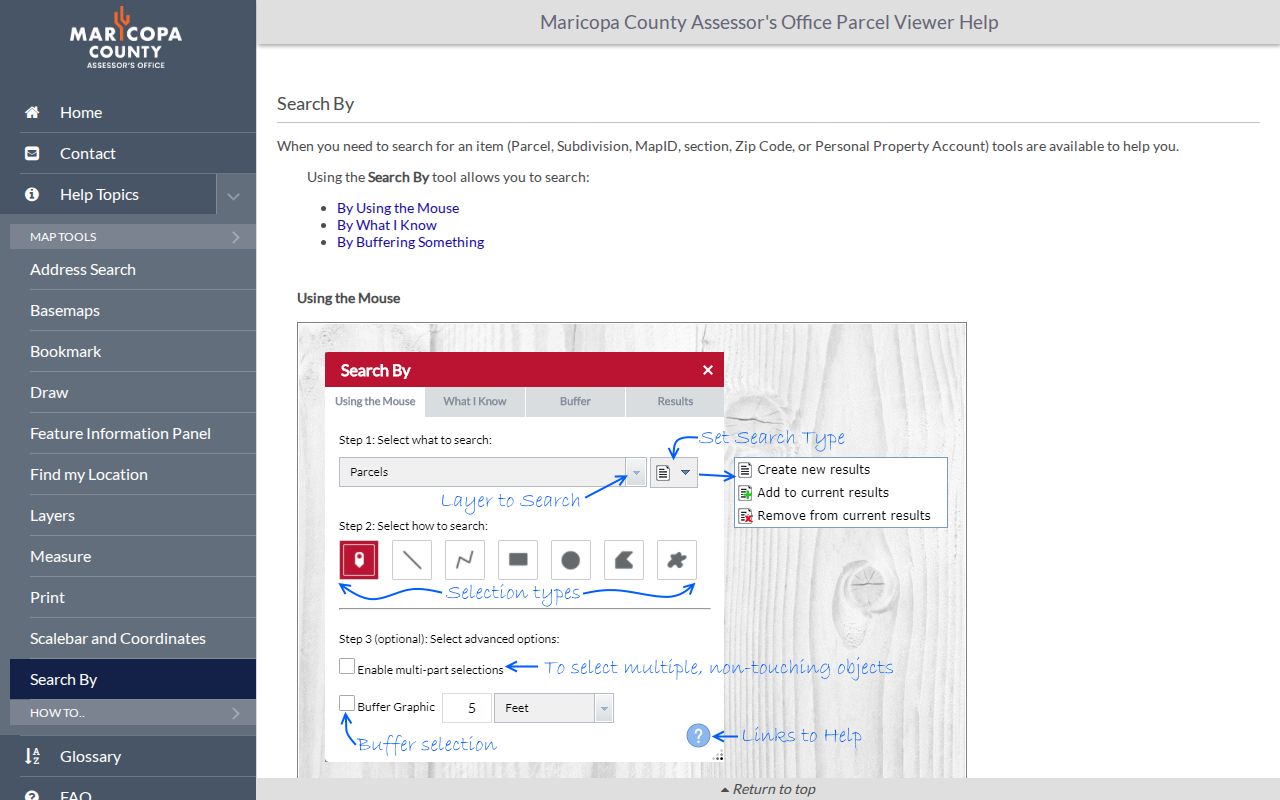
The cap changes the method. Search a subdivision, owner, APN, or exact address after the ZIP has supplied context. Clicking individual parcel polygons also helps distinguish bordering land from a huge postal result.
- ZIP
- A five-digit USPS delivery area that can cross government boundaries.
- ZIP+4
- The five-digit ZIP plus four digits that narrow a delivery segment.
- PO-box ZIP
- A postal code devoted mainly or entirely to post-office boxes; none was verified as Surprise-specific.
- Unique ZIP
- A code assigned to one high-volume organization; none was verified for Surprise.
- Carrier route
- A mail-delivery path within a ZIP, not a city boundary or household roll.
Surprise ZIPs Versus City Limits
Postal, municipal, and county record geographies overlap without becoming the same thing. A Surprise postal label can fall outside incorporated Surprise. Land inside the city can retain a legacy place label. The strongest local example is the 85361 area, where Wittmann mail geography and Surprise jurisdiction can coexist. ZIP 85378 also sits close to the Sun City West edge.
For one property, compare four facts: the USPS delivery result, the Assessor's physical city and ZIP, the parcel jurisdiction field, and an official city boundary layer. Then save the APN, subdivision or MCR, and legal description. Those land identifiers survive many postal and address changes better than the ZIP alone.
Addressing authority is itself a clue. Inside Surprise, Community Development and city GIS handle local address questions. In an unincorporated pocket with a Surprise or Wittmann mailing label, Maricopa County addressing rules may govern. An address assignment locates a site for response, records, and mail. It does not identify who lives there.
Complete the Surprise ZIP Record
After the correct parcel is known, the Maricopa County Treasurer supplies the tax-account path. Taxes assessed, paid, or due add parcel context but do not prove residence. The Treasurer search should follow the APN rather than a broad ZIP whenever possible.
The county tax lookup appears below as a separate official channel from the Assessor and USPS tools.
Keep each result in its lane: USPS confirms delivery, the Assessor describes the parcel, Parcel Viewer shows geography, the Treasurer reports the tax account, and the Recorder documents title transfers. Together they can verify land tied to a Surprise ZIP without claiming a public list of all people who live there.
A sound Surprise ZIP code directory result ends with the source and date. Save the standardized address, physical ZIP, jurisdiction, APN, and query date. Parcel counts and new-growth boundaries change, especially in 85387 and 85388. A repeatable citation is more useful than a screenshot with no search context.